
Contents
Introduction
This Battle of Worcester Walk is around ten miles and covers both the Southern Battle and the City Battle. It follows the battle grounds in the order events occurred (see timeline below) and this helps provide a good understanding of what happened. You will need to allow a full day to take it all in and, not least, to enjoy a leisurely lunch at the King Charles pub. The route is very flat, if you take your time and look at everything, you should be at the pub after about four hours. Then, not much more than an hour to finish.
I suggest that, if you are thinking of tackling the Monarch’s Way, this circular walk is a great way to begin; it provides excellent historical context.
Key stages in walk and battle
| Staging post | Battle time and event at staging post | Monuments | Distance to next staging post -miles / [km] | |
| 1 | Ketch Worcester Battlefield Viewpoint | 3 September 1651; 5:00am. Cromwell’s army were floating pontoon boats down the river. | Information board | 1.5 / [2.4] |
| 2 | Powick Church | Noon. Royalist troops guarding nearby Powick church were attacked and routed by Cromwell’s forces in the churchyard. | Information boards in the Church | 1.2 / [1.9] |
| 3 | Powick Bridge | 2:00pm. The Parliamentarians attacked the bridge which was held by the Royalists, defending the city. The defensive line held | Start of Monarch’s Way marker, information board and plaque about Scottish soldiers | 1.2 / [1.9] |
| 4 | The confluence of the River Teme and River Severn | 3:00pm. Bridges of boats built to take the Parliamentarians onto Royalist land. Fierce fighting. | Information board | 0.6 / [1.0] |
| 5 | Diglis footbridge | 4:00pm. Cromwell wins the Southern Battle. Charles comes down from the Cathedral Tower and leads troops to attack Cromwell’s forces North-East of the city whose numbers have been depleted, as many have been deployed in fighting near the confluence. When Cromwell saw the Royalist moves, he sent his forces back to his North-East camps to take on the Royalist troops. | Sculpture of Civil War soldiers | 1.5 / [2.4] |
| 6 | College Green, the Cathedral Close | The Cathedral played two roles in the Battle. Charles was positioned in the Tower for the early stages. Later, Royalist prisoners were taken to the nave. | Information board about the Refectory and Undercroft | 0.3 / [0.5] |
| 7 | Commandery Garden | The Commandry, once an Order of St John of Jerusalem hospital, for the Battle of Worcester it was used as the Royalist HQ. After the reformation, it passed through various private owners before becoming a museum in 1977. | Sudbury Bridge – replica weaponry and plaque about the battle. Commandery Garden – information board | 0.2 / [0.3] |
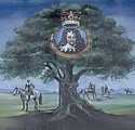
| 8 | Fort Royal Park | 5:00pm. Fort Royal was used by the Royalists to launch an attack against Cromwell’s troops in Redhill and Perry Wood, to the North-East. When the attack was repelled, the Parliamentarians overran the Fort and turned the guns on the City before chasing into the City to complete the victory. | Replica cannons, bas relief provided by Battle of Worcester Society and Liberty plaque and young oak trees. | 0.6 / [1.0] |
| 9 | St Martin’s Gate | 6:00pm. Charles re-entered by clambering over Sudbury gate and racing down Friar Street on horseback to his lodging in New Street, by St Martin’s Gate, before escaping with a group of officers through that gate. His lodging house is now the King Charles Pub, where I suggest you have lunch. If you do, look out for the fireplace on the ground floor and see if you can have a look at the atmospheric dining room upstairs. | King Charles House – plaque. Back of King Charles House – statue of the escaping Charles. St Martin’s Gate – plaque. | 2.4 / [3.9] |
| 10 | Opposite the confluence of the River Teme and River Severn | Revisiting staging post 4. | Information board | 0.6 / [1.0] |
| 1 | Ketch Worcester Battlefield Viewpoint. We are now back at the start. | Total distance | 10.1/[16.3] | |
The numbers of the staging posts are used in the map and in the directions below.
Directions
Start at the Ketch Worcester Battlefield Viewpoint. This is located near the traffic island where the A4440 intersects with the A38, 1.6 miles from M5 junction 7; turn left at the roundabout if coming from the M5, and soon right into the car park, before the petrol station, following the brown signpost saying ‘Viewpoint’. Post code WR5 3HR. First have a look from the viewpoint. Directions are then as follows:
- Using the underpass, cross to the other side of the A4440 and then use the footpath on that road to cross the Severn, soon using the available approach road, make your way to the ground beneath the road bridge. Once below, cross a large stile and then a gate into the field, walk at the edge of the field, parallel with the road. After about half a mile, go under the road and enter a field via a gate. Turn right to the field and follow the hedge line. Eventually, head out at 45 degrees, broadly, in the direction of the church tower. Cross a small stile, about 40 yards to the right of the electricity pylon, a small bridge, mount some steps and enter the churchyard. Look for the many musket ball marks in the church tower.
- Leave Powick Church via the main approach road and turn right. Eventually, cross the main road just before a petrol station, pass by Cromwell’s Car Wash, take the pedestrian flyover towards Powick Bridge. Powick Bridge is presently closed, (and will remain so until at least 2028) so you have to divert – go along the main road, doubling back along Old Road to get to Powick Mill. The Monarch’s Way starts at Powick Mill. Have a look at the damaged but wonderful bridge nearby.
- Then follow the River Teme to the confluence with the Severn, the large, near circular, loop taken by the Teme can be omitted. Arrive and pause at the Confluence.
- At the confluence, follow the Severn onto Worcester, still on the Monarch’s Way. Do not take the suspension bridge (Diglis Footbridge), stay on the west bank of the river, passing the Cricket Ground to your left. Cross the River via Worcester Bridge, near where the bridge was at the time of the battle. Pause to take in the iconic view of the Cathedral. Rejoin the River path, this time going South, along the East bank.
- Just past the Cathedral, leave the River via Water Gate, go to the College Green (now mostly school buildings).
- Go through Edgar’s Tower, the last trace of Worcester Castle, which was a prison at the time of the Civil War. Spectacular ruins of the former Monastery can be seen. After the Tower, you can turn left along College Precinct to see more of (and perhaps visit) the Cathedral. At all events, turn right at the main road. Just before the canal bridge, cross over the road to see the Commandery, near the site of Sidbury Gate. Briefly take the canal path by the Commandery and then divert right into the back garden of the Commandery.
- Go onto Wylds Lane and then into Fort Royal Park. Climb up into the park, seek out the cannons, the Liberty Oak plaque (tree now removed) and the battle plaque.
- Go back down and rejoin Wylds Lane, turn left. Turn right at the end of Wylds Lane, passing the Commandery. Arrive at and cross the dual carriageway, known as City Walls Road, along which a few fragments of the walls (which were destroyed by Cromwell after the battle) are preserved. Cross over and briefly carry on. Turn right into Friar Street, which Charles used to escape from the Sidbury Gate fighting. This road contains many remnants of Medieval Worcester, including the NT property Greyfriars House and Garden. Friar Street eventually becomes New Street, towards the end of which is the King Charles House pub, a fragment of the house where he lodged at the time of the battle and to which he briefly returned after fleeing from Sidbury Gate. This is the recommended lunch stop. At the end of the road, to the right, is another fragment of his lodging, now a hearing centre. There is a small statue of Charles escaping to be seen here. Moving slightly on, there is a plaque about St Martin’s Gate, where the King made his exit from the city.
- There are now Monarch’s Way signs (also Worcester Shrub Hill signs) to guide you to the Worcester/Birmingham Canal. Briefly – cross the road, go straight through the shopping centre and then passing through the multi-storey car park (unmarked large entrance to the right), turn right at the road and then cross at the pedestrian crossing and carry on through the retail park. You will soon reach and cross the pedestrian canal bridge, then turn right to join the canal path to take you back to the Severn. Take care to keep your eye open for the canal path as you pass through the marina and carry on to the river. In May 2026, a small bridge was closed, meaning a diversion through a residential area was necessary, leading to the Severn. Either way, at the river, turn left, and carry on, eventually reaching the confluence with the Teme.
- After the confluence, carry on by the river. After passing through an open area, look out for a concealed path in the bushes up to the left about 80 yards before the A4440 bridge. This path leads uphill and will take you back to the A38 via the Toby Inn grounds. Then use the underpass to get back to the car park.
Downloads
- If possible I suggest you use an electronic mapping system with the gpx file which is here.
- A much shorter Battle of Worcester Trail, concentrating on the City Battle here
Possible variants to walk
The Gold Standard would be to extend the walk further to include Barbourne Bridge – it was here that Charles stopped to confer with his officers after leaving the city. This is an important location, but not one that is marked in any way. To do this, you will need to walk along the A38 as it leads out of the City. To join this road, turn left onto the main road beyond the St Martin’s Gate plaque at the end of stage 8, following it as it goes left and then right, soon passing the Foregate Street Railway Station. It is a busy but interesting road, passing, for instance, Worcester Royal Grammar School and St George’s Square. After about a mile along the A38, come to Gheluvelt Park on the left and the bridge over Barbourne Brook. To rejoin the Monarch’s Way, turn right along Sunnyside Street, right at St George’s Walk and left at St George’s Lane North, carrying on until you reach the canal, along which is the Monarch’s Way route out of the city. Turn right to go back towards the Severn, rejoining the circular walk in a little less than a mile. Adding this in will make the circular walk around 12 miles. Or you could turn left to join the Monarch’s Way as it leads out of Worcester.
Alternatively, there are many straightforward ways to truncate the walk, perhaps concentrating on the city sections by starting and finishing at the Diglis Footbridge, accessible from Weir Lane, off Bromwich Road on the west bank of the river or from Diglis Dock Road on the east bank of the river.
Map
Have fun!